msp-tool
InaSAFE
Data and Resources
-
Project home page
-
Software repository
-
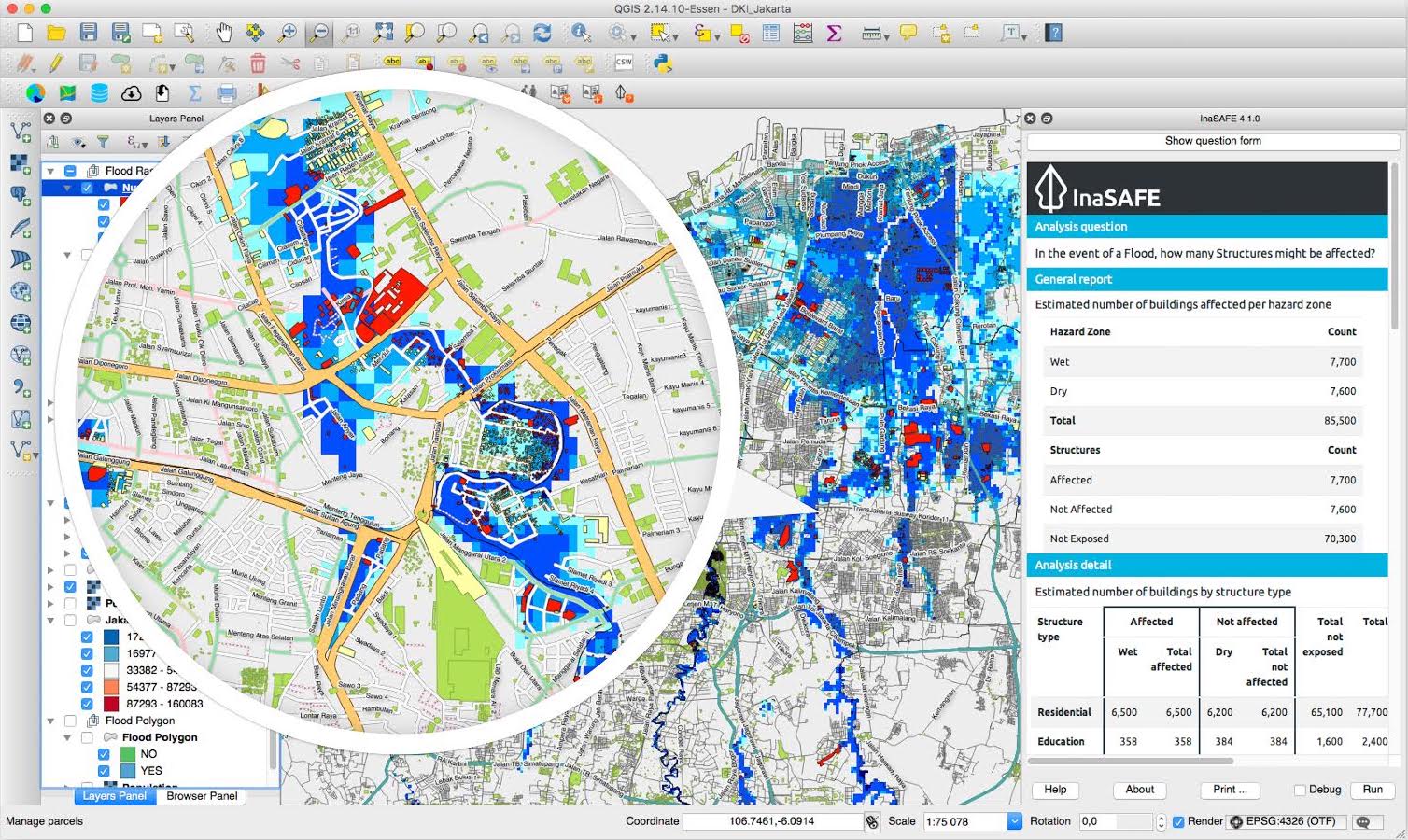
ScreenshotJPEG
additional_information
Additional Info
| Field | Value |
|---|---|
| Tool category | Scenario creation and analysis |
| MSP stages |
|
| MSP users |
|
| Type of software | QGIS Plugin/extension |
| Compatible OS |
|
| Input data |
|
| Output data |
|
| Organization | World Bank-GFDRR,Indonesian Government-BNPB,Australian Government |
| Code accessibility | Publicly available on GitHub |
| Software license | GNU General Public License (GPL) |
| Documentation |
|
| Tool community facilities |
|
| Additional informations | |
| Relevance for case studies | |
| Metadata completeness | Complete |